
OP
OP
Lewbrown
Member
This post is incredible!! I will be a week digesting all this information! Thanks so much!Purplelizard.com. Get their maps(which you may already have Loyalsock and Pine Creek if you backpack)View attachment 508742
They have all the roads and campsites on them.
If you do Facebook... Look up CentralPAOverland. https://www.facebook.com/groups/centralpaoverland/?ref=share
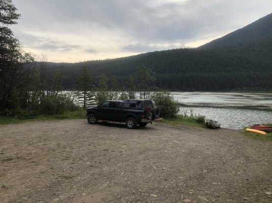
We just spent the weekend out in Rothrock, Bald Eagle and Tiadaghton State Forest.View attachment 508731
We went up to a hang glider site...but the snow brought fog...could not really enjoy the view.View attachment 508733View attachment 508734View attachment 508736
Another Vista gave a bit of clearingView attachment 508735
Right now in PA a there are even more roads open for travel right now for hunting season...we checked out a couple we had never been on. Love seeing the open gates. And got to love PA weather...View attachment 508741View attachment 508737View attachment 508738View attachment 508739
This route here covers all the forests in Central PA....sorry, not much on the east or west sides of the state.View attachment 508740
Here is the interactive map to our forest sites. Over 650 of them.
PA State Forest Camp Sites
maps.dcnr.pa.gov
You can go to ReserveAmerica.com to reserve and get more information.
Any specific questions ask away...I love talking about backpacking, car camping, travel trailer camping, tent camping, hammock camping, fishing hunting, maps, just all things outdoors...especially when the audience uses RAM trucks.